Comprehensive Wildfire Tracking Tool
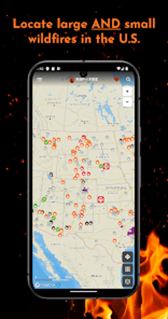
Map of Fire is a free Android application that provides real-time tracking of wildfires, lightning strikes, and smoke data across the United States. With over 30 data layers, users can access detailed information about wildland fire activity, fire danger ratings, risk assessments, and the Energy Release Component (ERC). This tool is essential for homeowners, outdoor enthusiasts, and professionals in firefighting, offering crucial updates on both major incidents and local fires that impact communities.
The app features an intuitive interface that ensures quick access to vital information, while advanced data layers cater to professionals and researchers. Users can monitor smoke plumes, lightning activity, and fire growth history, and the application keeps fires on the map until they are officially declared out by firefighting agencies. Additional features include smoke forecasts, evacuation information for Oregon and California, satellite heat detection, and customizable map preferences, making it a comprehensive resource for wildfire monitoring.